Indicator Gauge Icon Legend
Legend Colors
Red is bad, green is good, blue is not statistically different/neutral.
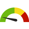
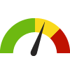
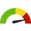
Compared to Distribution
 the value is in the best half of communities.
 the value is in the 2nd worst quarter of communities.
 the value is in the worst quarter of communities.
Compared to Target
 meets target;
  does not meet target.
Compared to a Single Value
 lower than the comparison value;
 higher than the comparison value;
 not statistically different from comparison value.
Trend

 non-significant change over time;
 significant change over time;
  no change over time.
Compared to Prior Value
 higher than the previous measurement period;
 lower than the previous measurement period;
 no statistically different change from previous measurement period.
 Significantly better than the overall value
 Significantly worse than the overall value
 No significant difference with the overall value
 No data on significance available
New Bike Lanes
This indicator is archived and is no longer being updated. Click to learn more
Why is this important?
Bikeways and sidewalks add to a healthy lifestyle while reducing neighborhood congestion, improving air quality and energy conservation, not to mention fuel cost savings. While the volume of pedestrian travel is much lower in the suburban and rural portions of Washoe County, it is still an important mode of travel, particularly for children going to and from school and recreation facilities. Pedestrian access to public transit from daily living activity areas are also important, e.g., travel to food stores, healthcare, schools, shopping areas, etc. Note that the following directly impact bicycle and pedestrian data:
- Seasonal weather (rain, wind, snow)
- Seasonal temperatures
- Air quality impacted by wild fires
- Gasoline prices
- Weekday vs. weekend traffic
- Bike lanes or sidewalks
- Wheelchair access
- Bicycle parking facilities
The Reno-Sparks Bicycle Pedestrian Master Plan (part of the Regional Transportation Commission’s (RTC) Regional Transportation Plan) aims at establishing a well-connected bicycling and walking network throughout Washoe County with safe and accessible infrastructure, which in turn, encourages an active, healthy lifestyle, reducing automobile traffic, with its associated noise, pollution and congestion.
Measurement period: 2022
Maintained by: Truckee Meadows Tomorrow
Last update: April 2023
Graph Selections
Data Source
- Regional Transportation Commission
Maintained By: Truckee Meadows Tomorrow
Filed under: Community / Transportation, Environmental Health / Built Environment, Physical Determinants of Health


